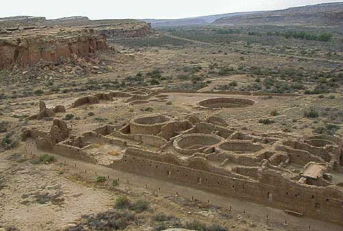
Suburban ChacoGreat houses, great kivas, round rooms/kivas, small houses, outliers, roads—the architecture of the Chaco Phenomenon—all derive their significance from what archaeologist Stephen Leckson termed "Downtown Chaco" (Lekson 1986: 272). The communal dwellings the Spaniards found in the Southwest in the sixteenth century they called "pueblos" ("towns" or "villages"). The name stuck, so that by the early twentieth century when Chacoan archaeology was well on the way, names like "Pueblo Bonito" ("Beautiful Town") and "Pueblo Pintado" ("Painted Town") were taken to signify just that, towns. (It's only in these latter days of massive populations compressed into ridiculously small geographical spaces that the concept "metropolitan area" has arisen.) So the notion of "Downtown Chaco," a city with many public and residential buildings (and, as I will propose, suburbs), is relatively new and, of course, anachronistic.
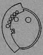
This is not the place to go into much of a discussion about these critical questions, though I'll touch on them at various points in these Reports. (Anyone who is interested would profit immensely by browsing around in The Chaco Handbook: An Encyclopedic Guide by R. Gwinn Vivian and Bruce Hilpert.) For now I'll go on the assumption that Chaco is a city, and a city, moreover, that has suburbs, that is, great houses not in Downtown Chaco but inside what is known as the Chaco Core (Vivian and Hilpert 2002: 67). Thus, suburbs, for me at least, are those great house communities that are neither in downtown Chaco nor are outliers. We'll take a look at four of these, one roughly in each of the cardinal directions from downtown. First, toward the southeast is Pueblo Pintado, which, at sixteen miles from Pueblo Bonito, must be considered a far-out suburb.Pueblo Pintado is notable historically because it was the first Chacoan structure encountered by a 1849 US Army expedition into Navajo country. A member of that expedition, 1st Lieutenant James Simpson, investigated the ruin that a Mexican guide, named Carravahal, called "Pueblo Pintado" and, after that, proceeded down Chaco Canyon to find what we now know as downtown Chaco. His is the first recorded account of the remains of this remarkable civilization (Frazier 1999: 25f). (Remember: history requires writing.) Pueblo Pintado had about 135 rooms, some of which were in 3-story blocks. (Black rooms are three stories, blue are two stories, white are one story.) Begun in 1060 and completed soon after, Pueblo Pintado was built at the height of Chaco's construction period.
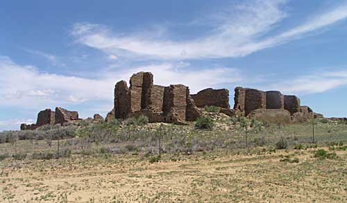
No one knows who these people were or exactly why they built what they did when they did. But knowledgeable scholars have ideas that might make sense. For example, David Stuart of the University of New Mexico believes that Pueblo Pintado was built in a feverish spurt in 1060-61 because the Chaco economy was depressed. The Chaco rulers sent surplus workers out to build a great house to keep employment up, just like Franklin Roosevelt's Works Progress Administration did in the 1930s (Stuart 1997:50). Maybe. Now let's go almost twenty miles through the Canyon, past the great houses and great kivas of Downtown Chaco, to Peñasco Blanco. Peñasco Blanco ("White Rock Point") is not only the third largest great house in Chaco Canyon (after Pueblo Bonito and Chetro Ketl) but, with construction beginning around 900, is also the third oldest (after Pueblo Bonito and Una Vida). It is also unique in being one of only two great houses on the south side of Chaco Wash (the other is Tsin Kletsin, see below) both of which are not actually in the Canyon but on the Chacra Mesa above. Yet another singular feature of this great house is its shape. Instead of the more usual D-shape or E-shape, each of which has at least one straight side, Peñasco Blanco is formed more like an oval. We might call it 0-shaped. 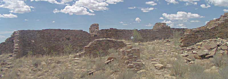 Peñasco Blanco on Chacra Mesa, west of Downtown Chaco
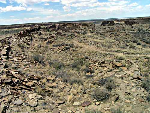
The West or Peñasco Blanco-Ahshislepah Road, begins near the Peñasco Blanco great house. It may, or may not, end at Ahshislepah Canyon, about eight miles away (Vivian 1990: 321) but, like all Chacoan roads, it is scarcely visible on the ground and then only by the trained eye.
|


)